InfoWater Pro
Model water systems within ArcGIS Pro
Engineers use InfoWater Pro software to model water distribution systems in an easy-to-use GIS interface.
- Leverage spatial analysis tools available in ArcGIS Pro to help with model building and management
- Run countless scenarios to simulate a wide range of simulations
- Present results clearly that you can share in ArcGIS Online
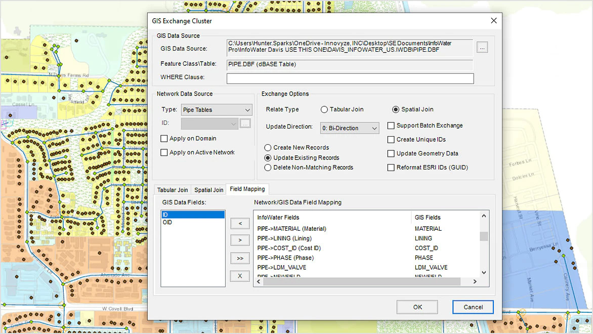
Seamless GIS data migration to InfoWater Pro
Make the most of your hard-earned GIS data to efficiently build and update your water distribution models, with a 1:1 relationship between InfoWater Pro models and ArcGIS Pro.
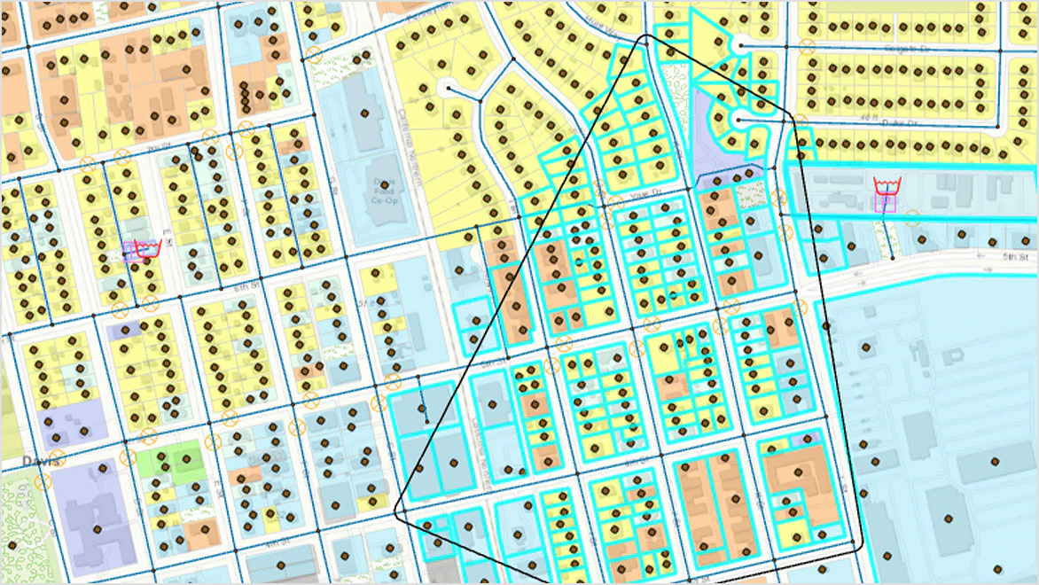
Take advantage of non-native modeling data
Use a customer layer to find out who will be affected by an incident and improve model calibration with more accurate demand allocation using meter data.
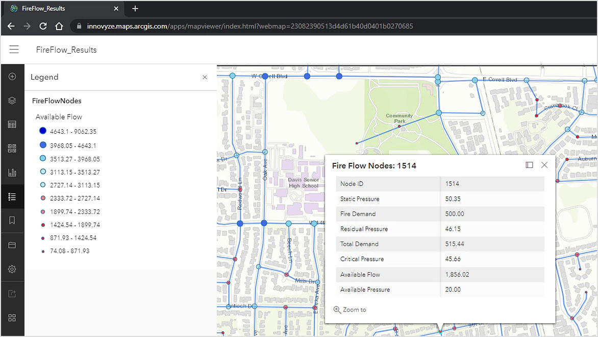
Share modeling information easily
The close integration of InfoWater Pro with ArcGIS Online and new Web Services makes it easy to share data within and outside your organization.
Benefits of InfoWater Pro
- Easily map and analyze water systems Map, design, and analyze water distribution systems from within ArcGIS Pro.
- Maintain service levels Ensure adequate pressure to serve customers even during fireflow events.
- Be prepared to respond to emergencies Find out how a pipe break, a fire, a contamination, or an outage would impact customers.
Search
Product Categories
![]()