Pix4Dmapper
Professional Photogrammetry Software
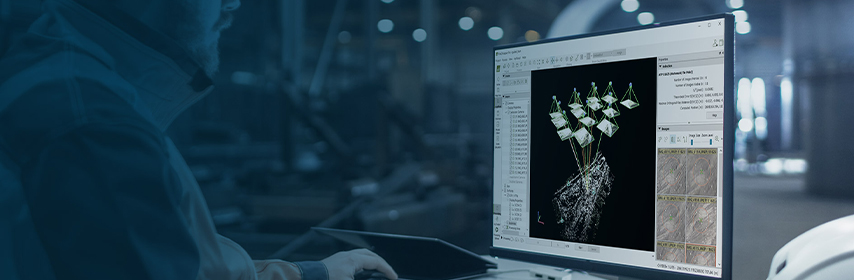
PIX4Dmapper transforms your images into accurate and georeferenced digital spatial models with sub-centimeter accuracy. Using a desktop computer or PIX4Dcloud, automatically convert images taken by drone, by hand, or by plane into highly precise 2D maps and 3D models. These outputs are customizable, timely, and complement a wide range of applications and software across industries.
Features Include:
- Automatic point cloud classification
- Flatten & smoothen digital surfaces
- Easily measure surface, distance & volume
- Control over the project accuracy
- Detailed quality report
- Full feature list
Get survey-grade results from images
Capture
Get RGB, thermal or multispectral images with any camera. Automate flights and image-data transfer when using a drone and the free PIX4Dcapture app.
Digitize
PIX4Dmapper’s photogrammetry algorithms transform your images in digital maps and 3D models. Seamlessly process your projects on your desktop using our photogrammetry software, or bundle with PIX4Dcloud for online processing.
Control & Measure
Assess and improve the quality of your project thanks to the detailed quality report and the rayCloud™ environment. Efficiently measure distances, areas, and volumes.
Collaborate & share
Selectively and securely share project data and insights with your team, clients and suppliers.
Search
Navigate
Stay Connected
Autodesk Platinum Partner
![]()

Join our Email List
© 2024 Topcon Solutions Store. All Rights Reserved.